Northern Tier Day #52 Rexford, MT to Libby, MT
Northern Tier Day #52
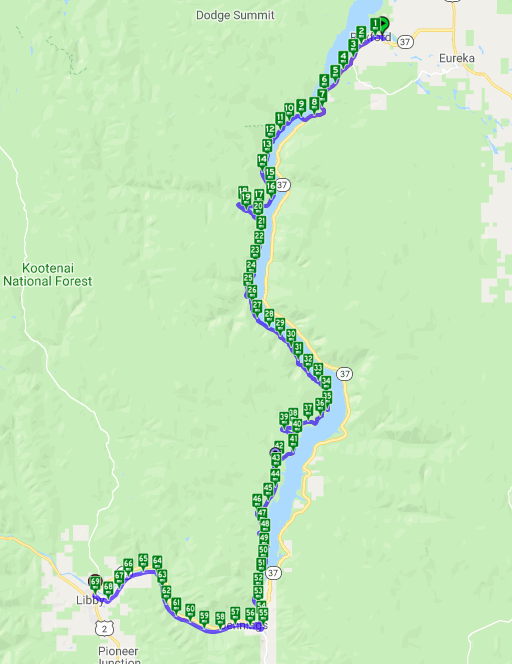
July 11, 2019 Rexford, MT to Libby, MT 69 Miles
Ride Time 5:59
Tour Total 4064 Miles
I had a fantastic night’s sleep last night in my tent at Rexford Bench Campground. It was a perfect temperature, and I didn’t climb into my silk liner until halfway through the night. There were no mosquitoes, it was quiet, and it didn’t rain. I had a slow gradual start this morning, easing my way into day #52. My towel was dry on the line, and I didn’t have to roll up a wet tent. I had an awesome picnic table to organize my things. My emergency stash of food made it through the night in the bear box. It was a great start! My only problem was that there would be no services for the next 68 miles. My granola stash in my rear right pannier immediately came to mind.
I started in my cycling shorts, jersey, and sweater. It was a little brisk, but not too bad. Out on Highway 37 I had 6 feet to the right of the rumble strip. I would be taking the ACA alternate route on the west side of Lake Koocanusa.
There was a lot of traffic, and I passed a deer. I needed to keep my eye on my odometer because I didn’t want to miss the 4,000 mile moment. At a certain point the shoulder narrowed to 4 feet. The speed limit was 70 miles an hour and 60 for trucks. I was doing 6.4.
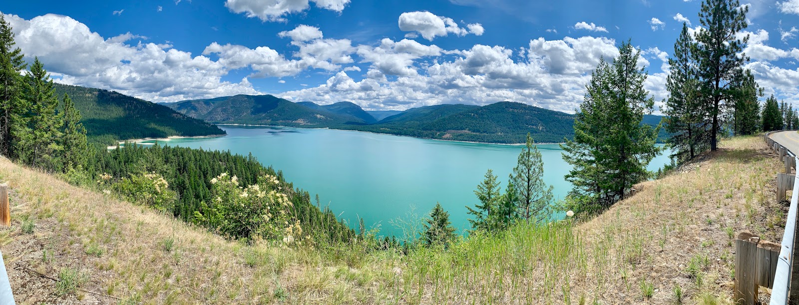
I was pedaling rolling ups and downs in the valley, with the large lake to my right and tall straight pine trees to the left. The lake came into view through the trees. It was 90 miles long and had an emerald hue. I would be spending most of my day riding alongside this lake from north to south.
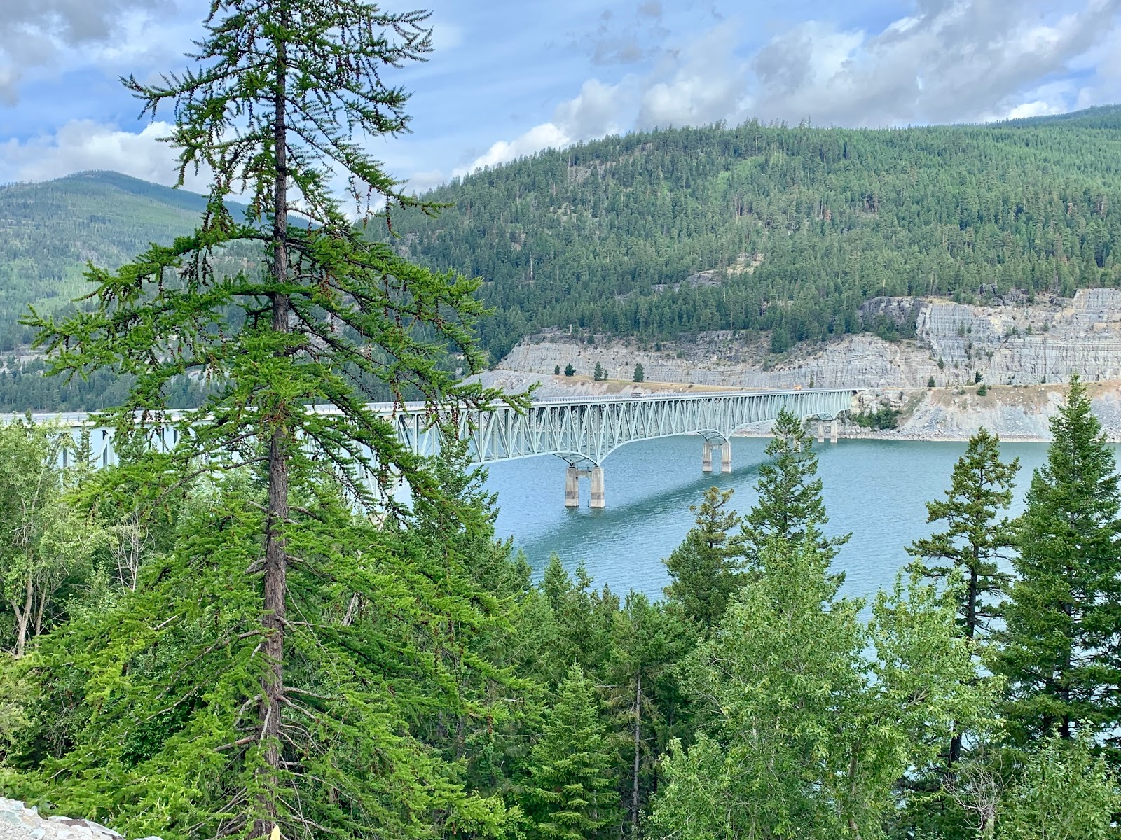
A deer startled me. I didn’t see it standing alongside the guard rail. As I approached, it jumped up and ran alongside the road. It crossed the highway and bounded over a fence into the trees. The shoulder was littered with tree bark from the timber trucks. I rounded a bend and the Koocanusa Bridge came into view from several miles away. It spanned the lake and was quite a long bridge. A gopher ran across the road.
Exactly one year ago was the infamous misadventure in Wisdom, MT. Read all about it on last year’s blog. Currently Steve G from last year‘s tour has made his way into Illinois on his second part of the TransAm. He broke his chain but had the tool to fix it. The 90°F heat is forcing him to shorten his days. His credit card was compromised and he’s down to a debit card. Asa from last year’s tour is in Indiana with no maps. I messaged him map screen shots this morning. He’s started noticing my stickers, and I told him to just follow them. Team Spokane is pissed that I’ve been writing they were from Tacoma. That’s like saying I’m from Queens. I believe I had it right, when I first met them.
I crossed over Pinkham Creek and admired the deep gorge that it had cut. I arrived at the long Koocanusa Bridge with 6 truss spans across the lake. The cool thing about the bridge was that it put me out in the middle of the water. I could see a mountain range far to the north. To the south and east were beautiful green waters. It was breezy and the wind was out of the south, which spelled a headwind for me. The water looked cold.
I was doing the ACA West Side Alternate Route. There were 3 large signs that read ‘This Road is not Maintained for Winter Use’, ‘Warning Watch for Falling Rock Next 26 Miles’, and ‘This is Grizzly Bear Habitat.’ FYI.
The side of the road was littered with avocado-sized pinecones. I noticed three vans carrying bicycles on the roof rack. I was on the west side of the valley and could now admire the steep ridge on the east side, that I had just been up against. The beautiful green lake was now to my left.
I encountered a shrine with a wooden crucifix held up by a pile of rocks. There were personal mementos and a cushion on the guard rail post. A day cyclist zoomed by me while I was admiring the shrine. I spotted a roadside huckleberry bush and pulled over for breakfast. I ate every ripe piece of fruit that was there. It was the only huckleberry bush I spotted.
This road must have cost a fortune to create. Firstly, there was the bridge. Then there were miles of man-made cut into the rock, 50-75 feet high at some points. I stopped to take a photo and 4 more cyclists passed me. Two girls passed, and one correctly identified that I was on a Surly. A whole pack was in my rearview mirror. They were part of Cycling House Tours, based out of Missoula. I wondered if all these cyclists were staying in Libby tonight. They got dropped off by a van and were riding south.
The cut finally ended, and I had pine trees to my right and left. Up above to my right was Cliff Mountain which I couldn’t see. Across the lake was Inch Mountain. I didn’t know which was more beautiful; the bluffs, the trees, the mountains, or the lake.
Big Creek stood out on the map because the route jags 2 miles to the west and then returns 2 miles east. It looked like a long crooked nose on the map. I crossed the bridge and listened to the gurgling water below. On my way back to the lake, the slope on the right side of the road was littered with large boulders. After about 20 minutes I was back riding along the lake again. I could see Highway 37 across the water, and spotted a campground on the east bank of the lake.
After 20 miles of pedaling, I stopped and pulled out my granola and a Cliff bar. Then I stopped again to remove my sweater, and applied sunscreen. Nature Valley Granola Big & Crunchy Oats & Dark Chocolate was fueling my ride today. There was no phone service along the lake.
I could spot the recent rockslides, and some of the rocks were enormous. I could also see where trees had fallen and the Forest Service had cut them to make the road passable. I passed two dudes, ostensively from the Forest Service, who were cutting up a large tree on the side of the road with a chainsaw. Signs were nailed to trees indicating that I was in an old growth forest. The ridges to either side of the lake were tall and steep, and I was in a deep narrow valley.
Unfortunately I need to comment on the litter that I saw along the road which was a crying shame. I’ve spotted plastic 7Up cups, Bud Light, Red Bull, and Coors Light cans. There were far more Bud Light cans than anything else. Big surprise there on the littering demographic. Come on crappy beer drinking motorists! Get your act together! This beautiful place deserves to be unspoiled.
There were bushes growing up out of the shoulder, which I suppose didn’t much matter because there wasn’t any traffic. Yo Montana DOT! This road needs a trim. I passed a red pick-up truck pulled over on the side of a rock cut. A guy with a sledgehammer was cracking large pieces of shale into smaller pieces, and loading the back of his pick-up truck.
This road is listed as a National Forest Scenic Byway. I saw a skunk cross the road, but I couldn’t smell it. At 40 miles into the day with 30 to go, I had used over half my water. It was sunny and hot, and I wouldn’t have minded a swim in the lake. It was a shame the road was so high above the water. I flew down a hill and then an uphill followed. I saw a squirrel scrambling alongside the road.
I’ve been noticing yellow mushrooms. The first few I saw were large, and then I spotted several smaller ones. I passed numerous 30 foot long sections of 3” wide yellow plastic tape tied to trees with 1" wide pink tape. I couldn’t understand the rationale. It was either a study of some kind, or a development survey.
All of a sudden the Libby Dam came into view, and I was way up above it. Then came the downhill sign. I stopped at a viewing station with 24 hour video surveillance in use. The drinking fountain didn’t work. Let’s get the priorities straight people! I raced down the hill behind the dam and found myself at the bottom of an enormous deep valley alongside the Kootenai River.
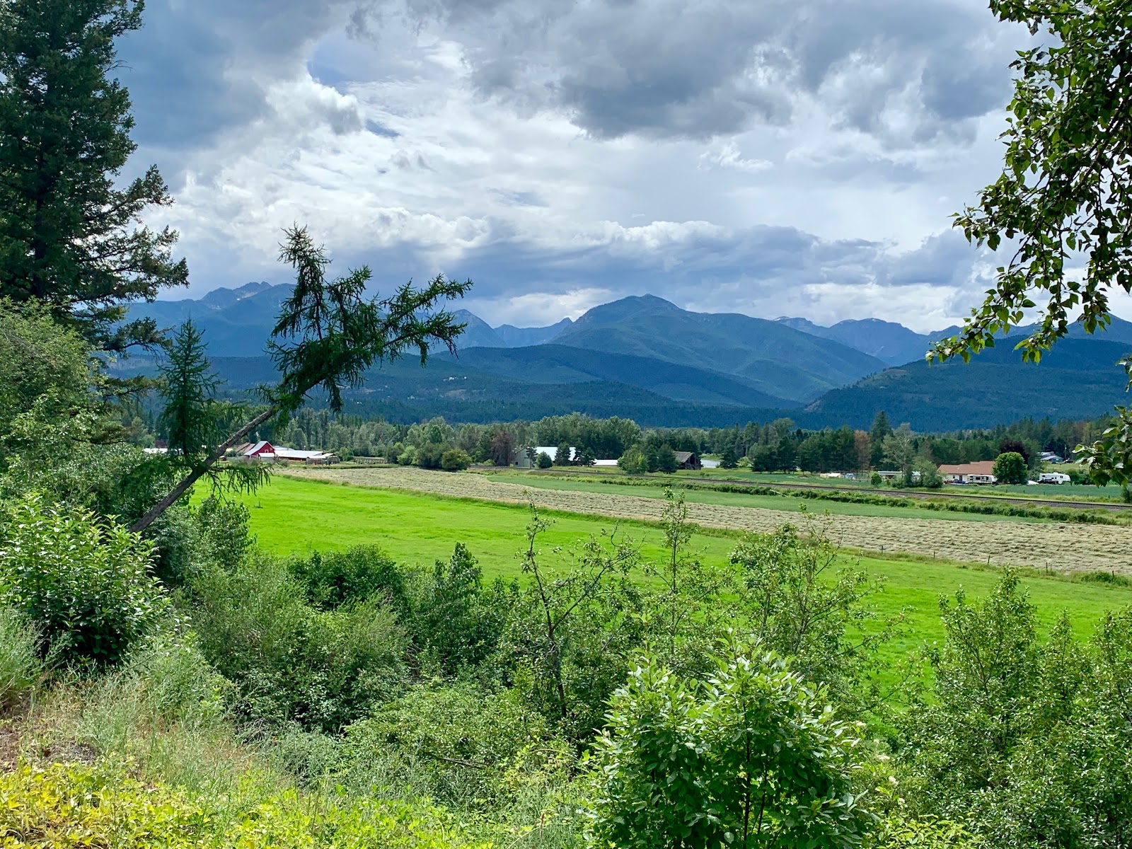
I reconnected with State Highway 37 and used it to cross the bridge over the river and back to the east side of the water. I took a right on Fisher River Road towards Libby. I soon found myself on tiny Old Haul Road that immediately paralleled a train track to my right and the river beyond that. There was a freight train with tank cars sitting idle, and I had a nice view of the river.
I had a strong headwind my last 14 miles into Libby. A freight train approached from the south and I got them to blow the whistle. It was about a mile long and hauling stacked containers. I climbed up above the tracks and later heard, but could not see, the southbound train pulling the tanker cars that I’d seen earlier.
I found myself traveling on a tiny wonderful road that I had completely to myself enjoying the fragrant smell of wildflowers. About 8 miles out from Libby, I discovered that I had cell service again. I got to work and found that I was 8.3 miles from the Cabinet Mountain Brewing Company, a 45 minute pedal according to Google Maps. My toes were starting to cramp up, and it was cloudy again.
I arrived at Cabinet Mountain Brewing and ordered a Kootenai Cream Ale, along with tacos and chips. I quickly had my four 12oz limit and had to search for my next watering hole. Please Montana! Change this stupid law and support your wonderful local brewing industry! I rode to the Switchback Bar & Grill amongst the sprawl on US Highway 3, where I ordered several Big Sky Brewery Summer Honey Ales out of Missoula, along with a cheeseburger and fries.


Comments
Post a Comment