Northern Tier Day #44 Hinsdale, MT to Harlem, MT
Northern Tier Day #44
July 3, 2019
Hinsdale, MT to Harlem, MT 96 Miles
Ride Time tbt (gps errors)
Tour Total 3504 Miles
I slept well last night in my tent on the concrete slab underneath the pavilion at Milk River Park in Hinsdale. I managed not to get decimated by mosquitoes. I was plugged in, so all my devices were charged in the morning.
It was nice to have a table to organize my things and pack my gear this morning. I did my best to prevent any of the brown dirt from coming with me. I shook out my tent and cleaned my clogs with the hose. The mud had a thick clay viscosity and was stubborn to remove. It was special to camp 100 feet from the Milk River’s edge.
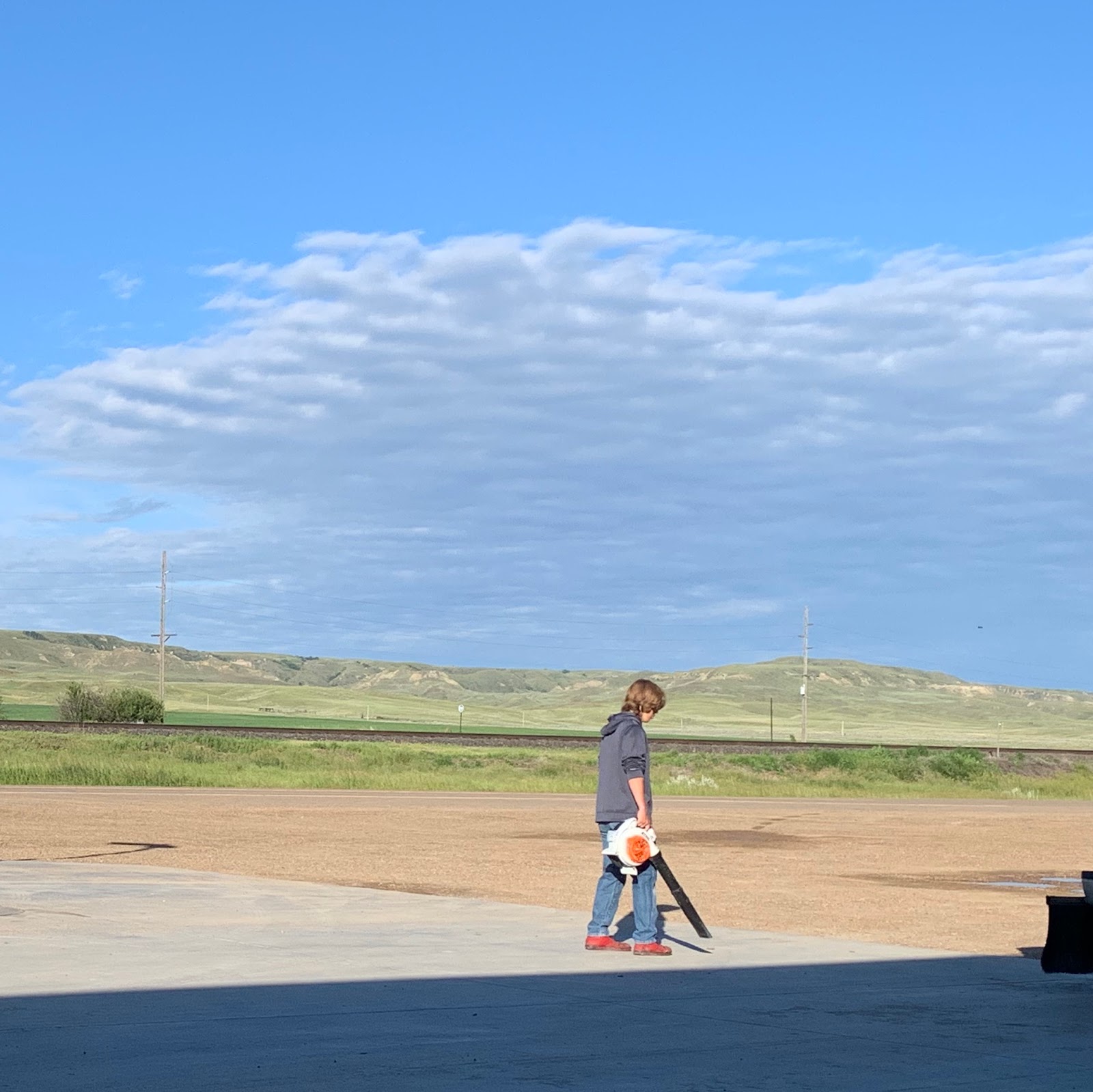
I fueled up at Ezzie’s Convenience Store aka Raiders Quick Shop, where I had the usual. I was trying to enjoy my breakfast, sitting on a bench out front, and this knucklehead kid was using a leaf blower to blow away the brown dust from the pavement around the pumps. I hate leaf blowers! They create awful noise pollution. That dust was going to be back in an hour. This whole state was dusty and dirty. Everything here was covered with mud and brown dust.
It was cool and sunny. The sky was mostly blue, but there were clouds on the horizon. Along with my cycling shorts and jersey I was wearing my leg-warmers, sweater, and rain jacket. There was a long beautiful ridge to the south. It was round and grassy to the east, and squared-off butte badlands to the west. The freight train tracks were immediately to my left. I heard several train horns last night and was glad to be down near the river away from them.
The ridge ended and I came out into more flats of grass, sage brush, and wildflowers. There were barbwire fences on both sides of the road, where where red-winged blackbirds were sitting. I had a group of seagulls follow me, which seemed odd in the middle of Montana.
The mosquitoes were really bad today. As long as I was riding I was fine. But I couldn't stop, or within seconds I’d be covered. They were able to sting through my leg-warmers, sweater, and gloves. My only safe haven was towns that had been sprayed.
I could spot the water tower in Saco from miles. In addition to cars, trucks, and campers, I was sharing the road with farm equipment. There were fields of rich green alfalfa grass, the hay that cattle prefer.
I’ve been loving all the appreciation I’ve been getting in my guestbook on Crazy Guy. Thanks everyone! Get out here and do a tour. I also love reading touring blogs. My favorites have been by Michael Riscica of Dude Robot fame. He’s done the TransAm twice and the Northern Tier once. His blogs are hilarious and great reads. I recently sent him a postcard.
A long freight train passed me to the south, and I passed a field full of large ginormous hay bricks the size of minivans. They were neatly stacked. I’d been used to seeing rolls of hay. Saco had a population of 197. I stopped briefly to have a mosquito-free break. I shoveled down some trail mix and was quickly back on my way. The 55th annual Saco Fun Days would be August 31 to September 2. Damn! I’ll be back in Brooklyn.
I had to pee really bad but didn’t want to get stung by mosquitoes. I tried Clint’s technique, and stopped out on the middle of a bridge and urinated over the guardrail into the creek. It was good advice, and I didn’t get stung. These are the sorts of useful things cyclists talk about. I was still on the Lewis and Clark Trail.
I was wearing the same clothes, socks, and underwear as yesterday, and I didn’t shower last night. That makes me cleanliness level two. If my readers would like to know more about the different levels, they’ll need to reference my 2018 TransAm blog. It’s described in Day #64 Corvallis, OR - Grande Ronde, OR. I’ve been aiming to stay at cleanliness level 1 this entire tour. For that reason I was planning to stop this morning at the Sleeping Buffalo Hot Springs.
At 9am the skies were gray, and it was still chilly so I left my rain jacket on. There were grass covered hills to the left and scrub filled flats to my right. I didn’t need maps or navigation aids today because I was staying on US Highway 2, Montana’s Hi-Line. I like to know how far away the services are, so I observe things like stream crossings, county lines, and where the road is in relation to railroad tracks. I was able to spot exactly where I was on the paper map.
Unfortunately the hot springs weren’t open when I arrived, and I didn’t want to wait another 20 minutes because I had a long day today. I’d have to find another place to bathe. I saw a bunny in the parking lot. Back out on the highway I encountered a Road Work Ahead sign. A cyclist had mentioned a washed out road near Saco, and I’d been keeping my fingers crossed. I soon realized it was nothing.
I passed miles and miles of nothing. There was grass, sage brush, and barbwire fencing. I saw a small mountain range to the south west in the direction of the Upper Missouri River Breaks National Monument. I determined it to be the Judith Mountains, the center of gold and silver mining in the 1800’s. Current exploration there continues.
I passed a huge field full of purple wildflowers. There’s no way my photos could do the beauty justice. I could see Malta from several miles out. I needed to go to the post office and get some Gatorade. The town, population 1997, was nothing like the island in the Mediterranean. It was dusty and depressing. It was a train depot that even offered Amtrak service. I haven’t seen a single passenger train on this tour.
I stopped at the Cenex station and had a Gatorade. I talked with a nice man who told me that I was now out of the severe mosquito area. I went to the post office and mailed a document for my commission and sent a few postcards. Twice today I’ve seen prairie dogs sitting straight up in the middle of the shoulder playing chicken with me. They wait until the last second to scurry off into the grass.
On my way out of town I crossed back over the Milk River. I had my own wooden deck crossing. Knowing there would be no more services, I stopped at the Westside Restaurant, where I had the hamburger on Wonder Bread with mashed potatoes special, along with hamburger and tomato noodle soup and lemonade. It was one of the most depressing places I’ve ever been in my life. There was an adjacent casino. All of these towns have an over abundance of bars and casinos.
The sun was trying to poke through but it was still cloudy. There were ominous dark clouds to the west. It seemed like it rains here every day, and I was told that it was the rainy season. After Malta I had a 2 foot wide shoulder with no rumble strip. I once again had the railroad tracks directly to my left. There were cattle off to the right with rolling grass hills beyond. I stopped at a roadside information sign about the outlaws in the wild west that used to terrorize this area, including Butch Cassidy and the Sundance Kid. I used the roadside opportunity to remove my leg-warmers and rain jacket. The mosquitoes and black flies drove me crazy.
The shoulder was narrow. Not only did I have to worry about westbound cars passing me, I was also concerned about speedy eastbound drivers who were passing other east-bounders. They would come into the westbound lane straight at me with 3 feet between us. Sheesh!
I crossed over the railroad tracks, and for the first time they were to my right. I got a much wider shoulder, thank goodness. I was admiring both of the small mountain ranges to the south, the Judith Mountains and the Bear’s Paw Mountains. There was definitely a weather system in the sky to the south. I had been lucky so far, and was keeping my fingers crossed.
There wasn’t much of an approach to Dodson, population 124. I didn’t see a water tower, and the grain elevator was small. There were no services and everything was closed. I passed two cute puppies that reminded me of Blanka. Then I passed a white dog who was asleep on a picnic table. He awoke and chased me to the corner of his yard. My pepper spray was ready in my hand, but unneeded.
An eastbound freight train passed me to the right, it’s horn blaring. I crossed over the Milk River and entered the Fort Belknap Indian Reservation. I had no cell phone service, and saw grass to my right with very mellow hills and gray puffy clouds above. I was sharing the road with telephone lines and a band of trees far to the left. I was afraid to stop because I didn’t want to get attacked by mosquitoes.
I left US Highway 2 to take an ACA detour onto Fort Belknap Route 6. It was a little bit longer then staying on Highway 2, but these maps were expensive and I wanted to squeeze every mile out of them that I could. In return I got 12 miles without a single motorized vehicle. There were puddles in the road and I wondered when it had rained.
Because the bugs were so bad I couldn’t stop for a moment, and I had to keep my mouth shut. I’ve seen numerous seagulls today which makes absolutely no sense to me, because I’m 950 miles from the coast. I heard that they come here for the lakes. I called the Harlem Town clerks office to get permission to camp in the city park tonight. She promised me that the sprinklers would be turned off. I had blood all over my fingers from killing engorged mosquitoes stuck to my legs.
I eventually got back on US Highway 2 and had a 2-1/2 foot wide shoulder to the right of the rumble strip. I passed purple and violet wildflowers to the side of the road all day today, in addition to the yellow flowers that I’ve been seeing for days. It was a nice change! At 4pm I spotted the water tower for the town of Fort Belknap Agency. It was overcast.
Several ginormous oversized semi-trucks passed me with both lead and follow vehicles. I felt small next to the large loads, and was fortunate that the motor vehicle behind me slowed down and waited for the load to pass, before he passed me.
In Fort Belknap Agency I passed a large service station and a casino. I didn’t stop because my destination was just down the road. I was now on the Nez Perce Trail. I left the Fort Belknap Indian reservation as I crossed the Milk River. Native Americans refer to it as the Little River. Lewis and Clark named it the Milk.
In the distance to the north I could see a freight train heading east. Then I spotted the water tower for Harlem. I kept my fingers crossed that it had even the smallest slice of Manhattan’s Harlem flavor, perhaps the food. Two semi trucks laden with humongous rolls of hay passed me going eastbound.
I rode over to the city park and discovered the town swimming pool, where I was able to take a shower and wash my dirty clothing. There was a young couple hanging out in the pavilion that I had my eyes on, so I rode over to Kennedy’s Bar and began ordering Dragon’s Breath Dark Hefeweitzens, from Missoula. I got take-out pasta from across the street. My Cyclemeter app screwed up today when I used my scanner app at the post office, and I don’t have proper GPS data. I’ll have to fix all of that when I edit my journey post tour.


Comments
Post a Comment